It feels like a while since we’ve had news about the Coastal Pathway in Tasmania’s north west but councils and the Cradle Coast Authority are busily working behind the scenes to deliver the next sections in the proposed 110 kilometre route.
What’s been delivered recently?
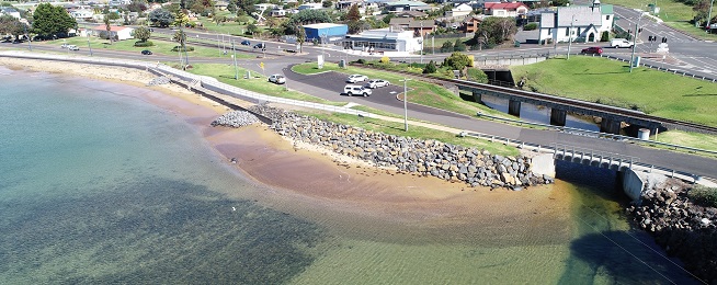
The most recently delivered section is the pathway around the Penguin foreshore that was opened along with a new sea wall just last month. The short section of shared path extends from the mouth of Penguin Creek to the Lions Park.
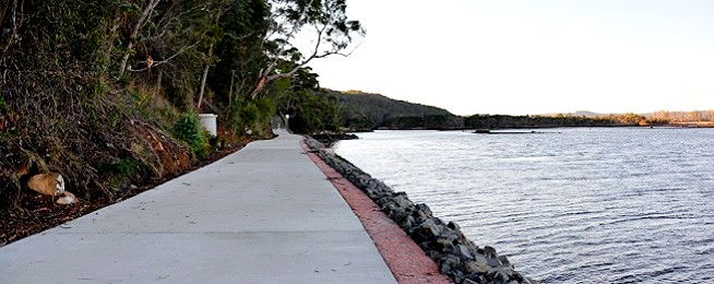
The other section opened in the past few months is the shared concrete path between Latrobe and Ambleside (on the edge of Devonport), which was opened in April this year. This is a fantastic first leg of the pathway with its riverside ambience drawing riders into a journey that will soon deliver them to the path that hugs the coast and port of Devonport.
The path starts near the end of Bells Parade in Latrobe, where you can park your car and set off alongside the river to the official start of the pathway. It ends in River Road Ambleside, where you can ride on the road or a standard footpath around to Tarleton Street and the path over the bridge which meets up with the Devonport foreshore track.

What’s on its way?
Devonport has identified the missing link between the Latrobe–Ambleside path and will build a shared path along River Road to link the two up to Ambleside Place, replacing the painted bike lanes. Work is being planned to begin at the end of this year/start of next year. Once this is built, you should be able to ride from Latrobe through to the Don River on an extremely scenic shared path that will be about 13.5 km one way, with great cafes and lunch options at either end. It’s also working with the Cradle Coast Authority to design a potential path from Don to Leith with planned delivery by the end of 2022.
It’s taken a while due to erosion problems, but Burnie and Waratah–Wynyard councils have started working on the design of the rail trail section of the pathway with Pitt and Sherry being appointed project manager. This section will begin at Port Creek in Wynyard and follow the old rail line around to Red Rock Point in Cooee on the outskirts of Burnie. Waratah–Wynyard Council has started work at its end sealing a car park and creating the first section of path from the Port Creek Bridge to the TasWater pumping station. Work was due to start later this year but will depend on resolution of erosion issues.
Central Coast Council are working with the Cradle Coast Authority on two new sections of the path. The Penguin to Sulphur Creek path will start in Sulphur Creek and run between the rail corridor and old highway to the Penguin Surf Club, then move to the edge of the road, cross over to Johnson Beach then into Penguin. The other path work soon to begin is Leith to Turners Beach, with the construction tender for this awarded in April.
The council recently approved an updated Cycling Strategy to 2025 which lists the sections of coastal pathway it’s due to deliver over the coming years. Once the current works are completed the sections left to go include: West Ulverstone Robertsons Road to Bertha Street and near West Beach, Leith Bass Highway Underpass to the East approx. 700m, Turners Beach Rd to eastern end of Esplanade, Ulverstone Beach Rd to Fairway Park and updgrade of the park paths, Penguin CBD to 581 Penguin Rd new and upgraded paths, and Heybridge to Sulphur Creek.
What’s not resolved?
Burnie City Council has still not settled on a preferred route east of the city to Chasm Creek. The initial Cradle Coast Authority plans had the path running along the coast next to the Bass Highway but the council has since proposed another route that would go inland through Fern Glade, over Round Hill and down to the highway. The council proposal would not be of use to locals wanting to use the path to get to work, schools and shops and services, and is in a much steeper area which would complicate the design and construction of the path because of the need to keep gradients accessible for all riders. It’s not clear when it will make a decision on which route it will pursue.
West Ulverstone to Penguin is another problematic section of the pathway because of a narrow road reservation, steep embankments and the rail corridor. Design work is continuing on this section to overcome these barriers.


